 29+Years
29+Years
29+Years


2 Available
Condition: New

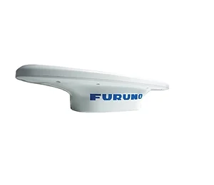
Furuno SC33 Compact Dome Satellite Compass, NMEA2000 (0.4 degree Heading Accuracy) w/6M Cable
Model: SC33The SC33 Satellite Compass provides highly accurate attitude information for navigation equipment such as Radar, Plotter, Autopilot, Fish Finder and Sonar. With its compact GNSS antenna and built-in processor, it can be used for a wide variety of applications on any type of vessel. This all-in-one system delivers incredibly accurate heading and roll & pitch information as well as heaving information, GPS position, SOG (Speed Over Ground), COG (Course Over Ground) and ROT (Rate Of Turn) data.
Employing a two-antenna system with a 3-axis gyro and acceleration sensors, the SC33 enables high-speed response capability. Advanced digital signal processing techniques compute accurate heading based on sensor data. NMEA2000 interface is standard for simple installation, while the optional interface unit IF-NMEASC is available for conventional NMEA0183, AD10 and contact closure.
A new GNSS antenna and advanced parallel signal processing allows the SC33 to achieve more precise Pitch, Roll and Heading measurement than conventional models, providing enhanced performance for all of your connected equipment. Its Micro-C pigtail NMEA2000 cable provides flexibility to run cables in challenging areas.
In order to calculate roll & pitch data, a satellite compass requires two vectors. The SC33 employs a dual GNSS antenna system that calculates a single vector while a 3-axis rate gyro and acceleration sensors add the 2nd vector. This configuration enables the SC33 to calculate highly accurate roll and pitch data without using a third sensor.
Specifications| Antenna Type | Radome |
| Display Size | Supplied Separately |
| Power Usage | 12-24 VDC |
| Data Type | NMEA2000 |
| Display Type | Supplied Separately |
| Receiver Type | GPS |
The Furuno SC33 Satellite Compass System is designed for business and IT buyers in the maritime sector requiring precise attitude information. This system provides accurate heading, roll, pitch, and heaving data, alongside GPS position, Speed Over Ground (SOG), Course Over Ground (COG), and Rate Of Turn (ROT) data. It is suitable for integration with existing navigation equipment such as Radar, Plotter, Autopilot, Fish Finder, and Sonar. The SC33 utilizes a compact GNSS antenna and a built-in processor, making it adaptable for various vessel types. Its two-antenna system, combined with a 3-axis gyro and acceleration sensors, enables high-speed response and precise data calculation. Standard NMEA2000 interface simplifies installation, addressing connectivity needs for modern marine electronics. The system operates on 12-24 VDC power.


The SC33 outputs NMEA2000 data. It provides highly accurate heading, roll & pitch information, heaving information, GPS position, SOG (Speed Over Ground), COG (Course Over Ground), and ROT (Rate Of Turn) data.
The box includes the SC33 unit, a 6-meter NMEA Drop cable, necessary hardware for installation, adhesive, and documentation. Display units are supplied separately.
The SC33 Satellite Compass offers a heading accuracy of 0.4 degrees. This precision is achieved through its dual GNSS antenna system, 3-axis gyro, and acceleration sensors.
Yes, a display unit is supplied separately. The SC33 outputs data for integration with existing navigation equipment and does not include a dedicated display.
SC33 - Furuno Satellite Compass System with 2 Antennas and Display





























































