 29+Years
29+Years
29+Years
Special Order
Ships in 1-2 weeks
Condition: New

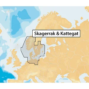
Skagerrak & Kattegat - microSD™
Experience the best in nautical navigation with Navionics+. This premium marine and lakes content offers comprehensive coverage and value.
Features Include:
Coverage Area:
Includes Denmark, Germany (from Delfzijl to Kolobrzeg in Poland), and Norway from Flekkefjord to Oland South in Sweden, covering regions like Skagerrak, Kattegat, Oslo, Copenhagen, Goteborg, Bornholm, Sjaelland, Lolland, Fyn, and German Lakes.
Note: This product may not be returned to the original point of purchase. Please contact the manufacturer directly with any issues or concerns.
The Navionics Skagerrak & Kattegat MAP, part number MSD/NAV+45XG/ROW, is a maritime navigational chart solution designed for business and IT buyers managing fleets or marine operations in specific European regions. This product provides comprehensive marine and lake navigation data on a microSD card. It integrates Nautical Chart, SonarChart�, and Community Edits onto a single card, offering detailed mapping for operational planning and execution. A key feature is the high-definition SonarChart� layer, which can be enhanced by uploading sonar logs. The solution includes a one-year subscription to daily updates via the Freshest Data feature, ensuring current navigational information. Coverage spans Denmark, Germany (from Delfzijl to Kolobrzeg), and Norway (from Flekkefjord to Oland South in Sweden), encompassing areas such as Skagerrak, Kattegat, Oslo, Copenhagen, and German Lakes. This product is suitable for organizations requiring reliable and updated navigational data for their vessels operating within these defined geographical boundaries.
MSD/NAV+45XG/ROW - Navionics Skagerrak & Kattegat MAP





























































