SKU: FGDD5PL6X4 |  Mfg. Part: 010-C1369-40  | UPC: 821245991768  | 
 1 Reviews
 |     Share

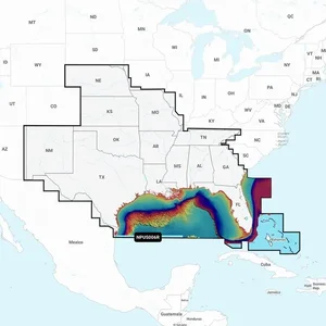
010-C1369-40 - Navionics Platinum+ NPUS006R - U.S. South Marine Charts

50 Available
Condition: New

$208.78  $281.85
Free Shipping for this Item

Product Overview

Navionics Platinum+ NPUS006R - U.S. South Marine Charts

Experience superior navigation with Navionics Platinum+ charts, which include all the essential features of Navionics+ cartography. Benefit from integrated offshore and inland mapping covering 42,000+ lakes, and take advantage of additional options like relief shading, satellite imagery with SonarChart shading overlay, 3D perspective view, aerial photos, and much more.

Charts & Updates:

  • Nautical Chart Comprehensive charts based on multiple sources offer a familiar look and feel.
  • SonarChart HD Bathymetry Innovative 1' (0.5 m) bathymetry charts use community-contributed sonar data.
  • Community Edits Gain insights from local knowledge shared by users of the Navionics Boating app.
  • Daily Updates Enjoy up to 5,000 daily updates for the most accurate Navionics data.

Advanced Features:

  • Dock-to-dock Route Guidance Get suggested paths to start your journey.
  • SonarChart Live Mapping Feature Monitor the development of new HD depth maps in real time.
  • Advanced Map Options Customize your map view to highlight details important to you.
  • Plotter Sync Transfer routes, update chart layers, and sync data between your chartplotter and the Boating app.

Overlays:

  • Relief Shading Enjoy a clearer view of underwater structures.
  • Satellite Imagery with SonarChart Shading Overlay Enhance your awareness both above and below the waterline.
  • Sonar Imagery Clearly view bottom hardness using contrasting colors.

Platinum+ Additional Viewing Options:

  • 3D View Adjust chart perspectives to better highlight key features.
  • Aerial Photos Gain a better sense of your surroundings.

Coverage Areas:

  • Worldwide map coverage available, making it easy to select desired navigation features and map regions.
  • Options for large coverage areas and localized chart cuts.

Compatibility:

  • Ensure compatibility of Platinum+ content with your GPS chartplotter.

1 Subscription is required.

2 Dock-to-dock Route Guidance is for planning only and does not replace safe navigation operations.

3 Some chartplotter models do not require a subscription for the SonarChart Live mapping feature; latest firmware release required.

**NOT FOR USE IN GARMIN CHARTPLOTTERS**

Technical Specifications

  • Comprehensive nautical charts with integrated mapping.
  • Real-time HD bathymetry with community-contributed data.
  • Daily updates ensure that charts are always current.
  • Interactive 3D views and advanced customized mapping options.
  • Sync between devices for seamless navigation experience.
  • Community insights via the Navionics Boating app.

Product Details

  • Manufacturer:
  • Model Number:
  • ASIN:
  • UPC:
  • Condition:
  • Weight:
  • Dimensions:
  • Updated:
  • Added:
  • Navionics
  • 010-C1369-40
  • B0BBT6MH5Y
  • 821245991768
  • New
  • 0.22 lbs
  • 6 X 1 X 5
  • Today - May 30, 2026
  • Feb 21, 2022
Product Identifiers: Brand: Navionics • Part #: 010-C1369-40 • UPC: 821245991768 • ASIN: B0BBT6MH5Y • Category: GPS Software & Maps

010-C1369-40 - Navionics Platinum+ NPUS006R - U.S. South Marine Charts

Reviews for Navionics 010-C1369-40

$208.78